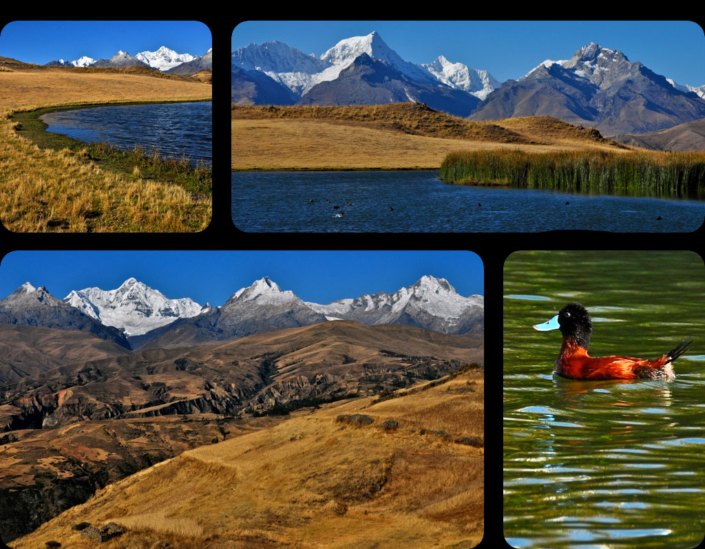
 |
| |
|
|
| |
Trip Duration Half day (approx 5 hours)
Hike Duration 2 hours up, 1 hour down
Trip Type Half-day hike
Grading Easy
Places Visited Lake Wilcacocha
Starting Point of Hike Chiwipampa
Finishing Point of Hike Chiwipampa
Highest Point Lake Wilcacocha 3700m
Distance 10km
|
|
| |
|
|
|
| |
Lake Wilkacocha is a small lake situated at 3700m, high in the Cordillera Negra, where flocks of ducks like to swim and cows, sheep, donkeys and horses munch peacefully on the surrounding grass.
The hike up to the lake passes several small Andean villages, where colourfully dressed local people still follow a traditional way of life.
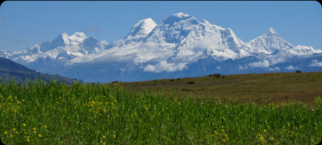
The highlight of a visit to Lake Wilkacocha is the breath-taking panoramas from a hillock by the lake, with superb views of the Cordillera Blanca, including the perennially snow-capped peaks of Mount Huantsan (6395m), the range’s third highest summit, Shaqsha (5703m), Cashan (5716m), Rurec (5700m), Tumarinaraju (5668m), Churup (5495m), Ranrapalca (6162m) and Vallunaraju (5675m).
This spectacular view of the ‘White Range’ is one of the best in the region.
The lake is located only 10km from Huaraz. It is an ideal first acclimatisation hike, and can easily be done in half a day.
|
|
|
|
|
|
|
| |
|
|
| |
We leave Huaraz at 1 pm and drive southwards along the main road. A mere ten minutes later, we reach the trailhead at Chiwipampa. Almost immediately, the trail starts ascending steeply towards the village of Santa Cruz, which is located in the Cordillera Negra. We walk on upwards past traditional Quechua homes and fields where the local people cultivate potatoes, wheat, beans and corn. After approximately two hours of hiking, we reach the picturesque lake and are granted magnificent views of the Cordillera Blanca. Our efforts are amply rewarded with some of the most impressive panoramic views of the region. A rapid descent brings us back to the main road from where we catch our transport back to Huaraz. We get back to town at around 6 pm.
|
|
| |
|
|
|
|
|